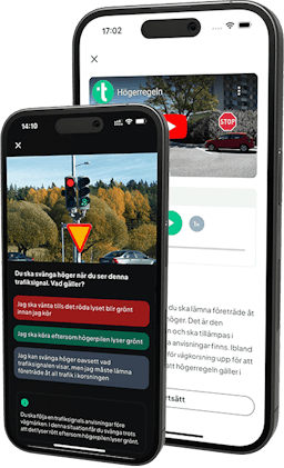
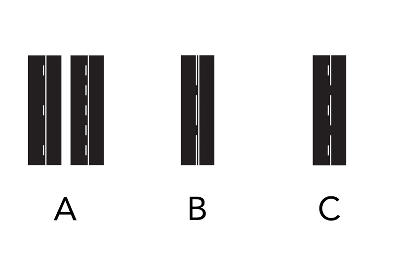
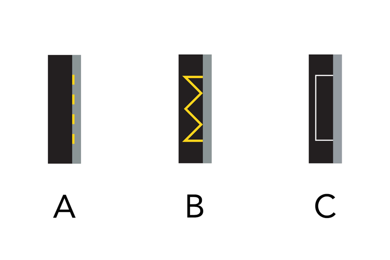
Centre line or lane marking (A): The centre line indicates the border between lanes for travel in opposite directions. Lane markings indicate the border between lanes for travel in the same direction.
Edge line (B): This marking indicates the outer border of the carriageway.
Warning line (C): Warning lines are used to warn drivers that it is inappropriate to cross the line due to traffic conditions.
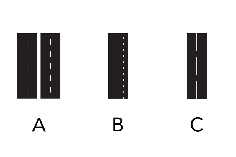
Guide line (A): This marking indicates the appropriate route for traffic at complicated junctions.
Bicycle path line (B): This marking indicates the border between a bicycle path and another lane.
Line for public transport vehicles, etc (C): This marking indicates the border between a lane for public transport vehicles, etc., and another lane.
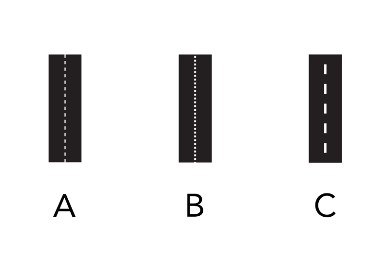
Reversible lane (A): This marking indicates a lane which can be used interchangeably by traffic going in both directions.
Solid line (B): A solid line can be a centre line, a lane marking or an edge line. Generally speaking, you may not cross a solid line.
Obstruction marking (C): This marking indicates an area where vehicles may not be driven. Exceptions: If necessary in order to pass an obstacle on the road or if there is insufficient space at a junction.
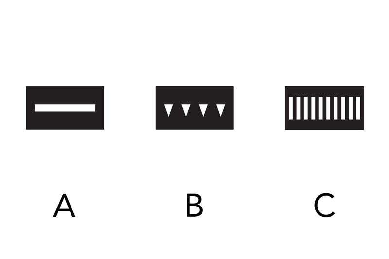
Centre line or lane marking and solid line (A): This marking is used when it is not permitted for the vehicle on the same side as the solid line to change lanes.
Warning line and solid line (B): This marking is used when it is not permitted for the vehicle on the same side as the solid line to change lanes.
Centre line and warning line (C): This marking is used when it is inappropriate to cross the warning line due to traffic conditions.
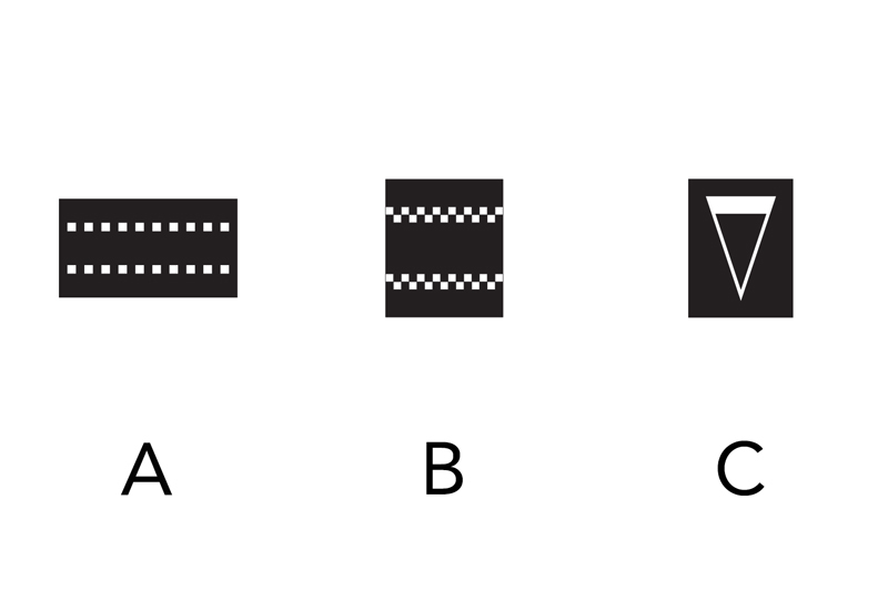
Stop line (A): This marking indicates where a vehicle should stop according to a road sign, traffic light or horn at a level crossing.
Give-way line (B): This marking indicates the line beyond which a vehicle should not pass when the driver has a duty to give way.
Pedestrian crossing (C): This marking indicates a pedestrian crossing and is in places where road sign B3 (pedestrian crossing) is displayed.
Bicycle passage or bicycle crossing (A): This marking indicates a bicycle passage or a bicycle crossing in places where road sign B8 (bicycle crossing) is displayed. If the marking refers to a bicycle crossing then it should be combined with a give-way line.
Traffic-calming device (B): This marking indicates a traffic-calming device in the form of a speed bump, dip or similar.
Advance information about duty to give way or to stop (C): This marking indicates that there will be a duty to give way or to stop further along the road.
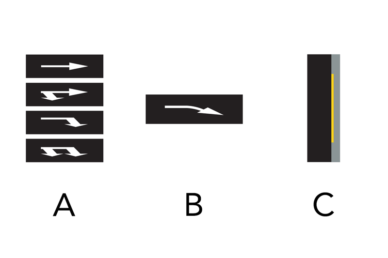
Lane selection arrows (A): This marking indicates the appropriate route for continued travel at the nearest junction. If the lane is demarcated by a solid lane marking, then the driver must follow the direction or directions indicated by the arrow.
Change of lanes (B): This marking indicates that the driver must change lanes as soon as possible.
No stopping or parking (C): This marking informs drivers that it is not permitted to stop or park and can be found at the edge of the carriageway.
No parking (A): This marking informs drivers that it is not permitted to park and can be found at the edge of the carriageway.
No stopping and parking or no parking (B): This marking is used to reinforce marking M21 (no stopping or parking) and marking M22 (no parking).
Parking space (C): This marking indicates the border of a vehicle parking space. It can also be a broken line rather than a solid one.
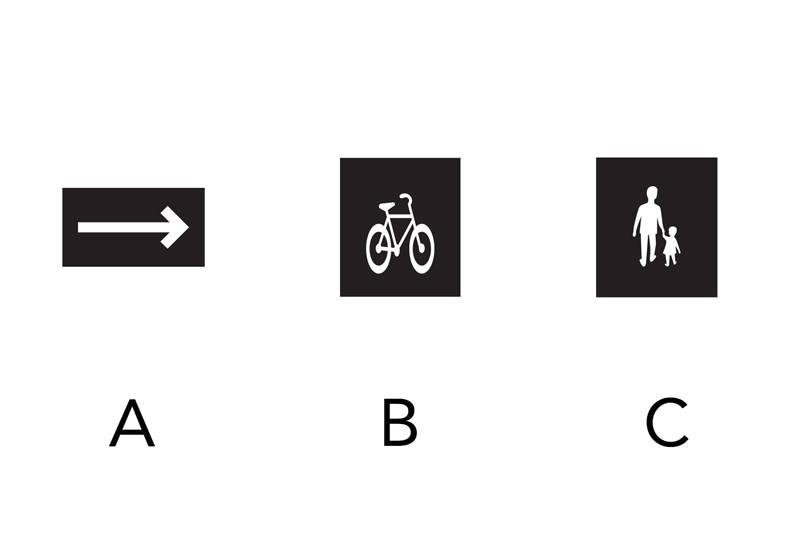
Pedestrian and bicycle arrow (A): This marking indicates the appropriate route for pedestrians or cyclists and drivers of class II mopeds.
Bicycle (B): This marking indicates the lane to be used by cyclists and drivers of class II mopeds.
Pedestrians (C): This marking indicates the lane or appropriate route for pedestrians.
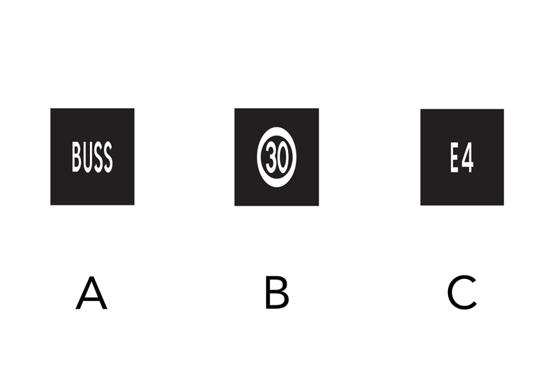
Bus (A): This marking indicates that the lane is intended for public transport vehicles, etc.
Speed (B): This marking indicates the maximum permitted speed.
Road number (C): This marking indicates the road number.
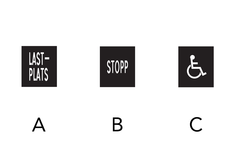
Specific purpose area (A): This marking indicates an area that is intended for a specific purpose. The text will reflect what this purpose is.
Stop (B): This marking indicates a duty to stop. It is used together with road sign B2 (duty to stop) in order to reinforce the instruction.
Disabled (C): This marking indicates a parking space that is only for use by the disabled.
Information: This marking provides information, warnings or guidance that is important for road users.